Thursday, June 7, 2012

Machupicchu - At Last

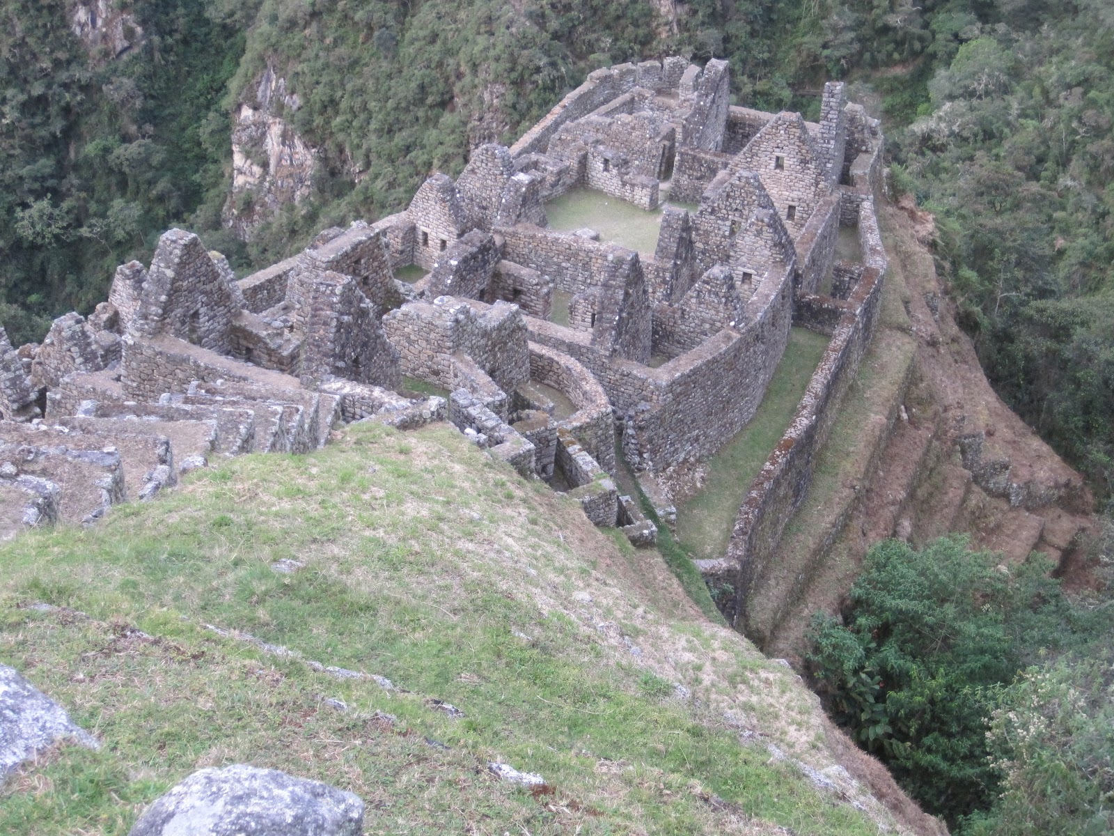
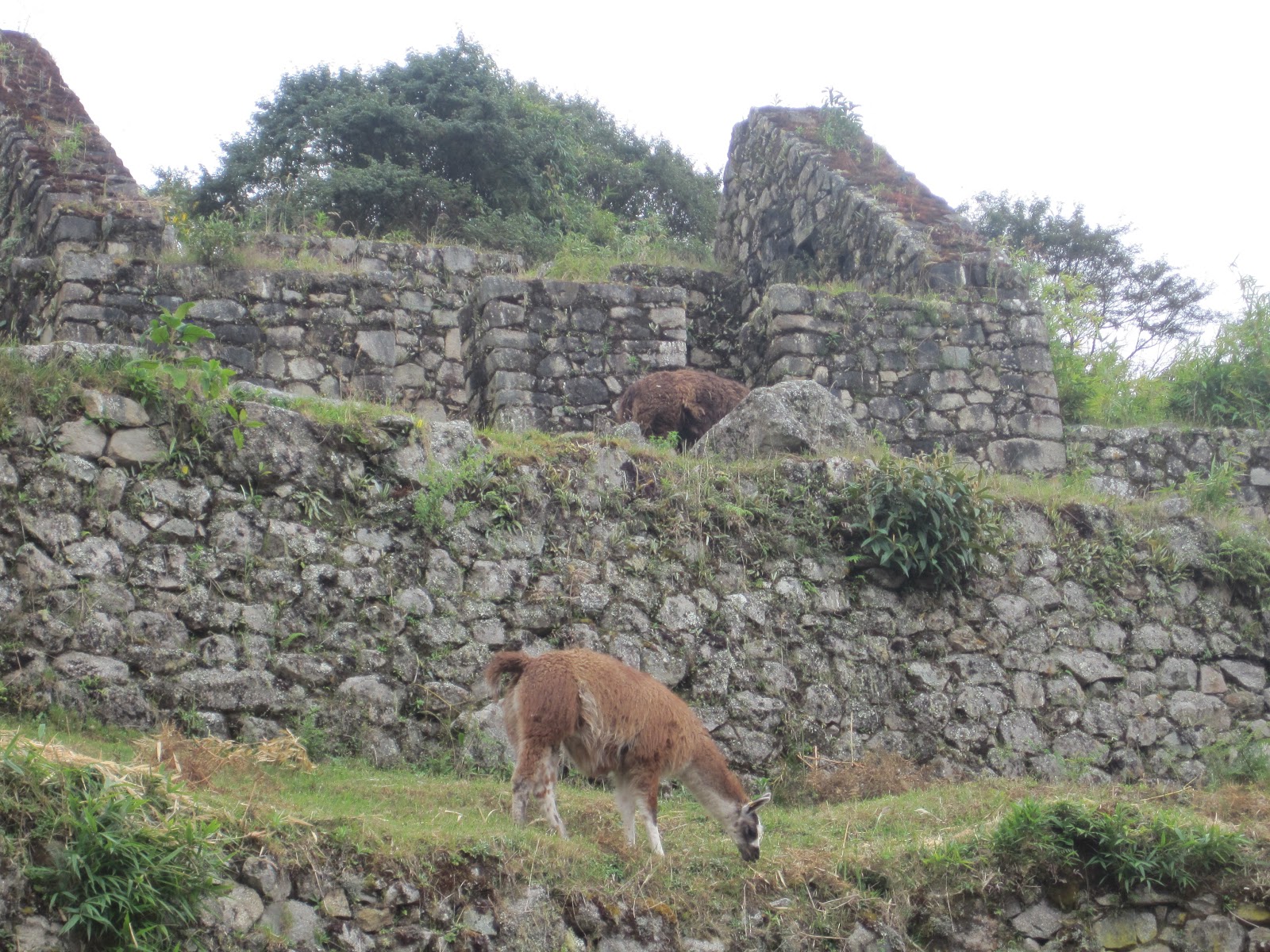
The Incan city of Machupicchu was built in the mid 15th century. The Incan Pachakutek designed it but would not have lived to see its completion. Given the number of enclosures to house families, it is thought that 500 people lived here at a time. In the dwelling and other buildings the stones were made to fit together to allow for settling. Most of the structures are in perfect condition except for the fact that the roofs, which were made from wood beams and thatching, are missing. Archeologists have restructured roofs on some of the dwellings to show how they think they may have looked originally.
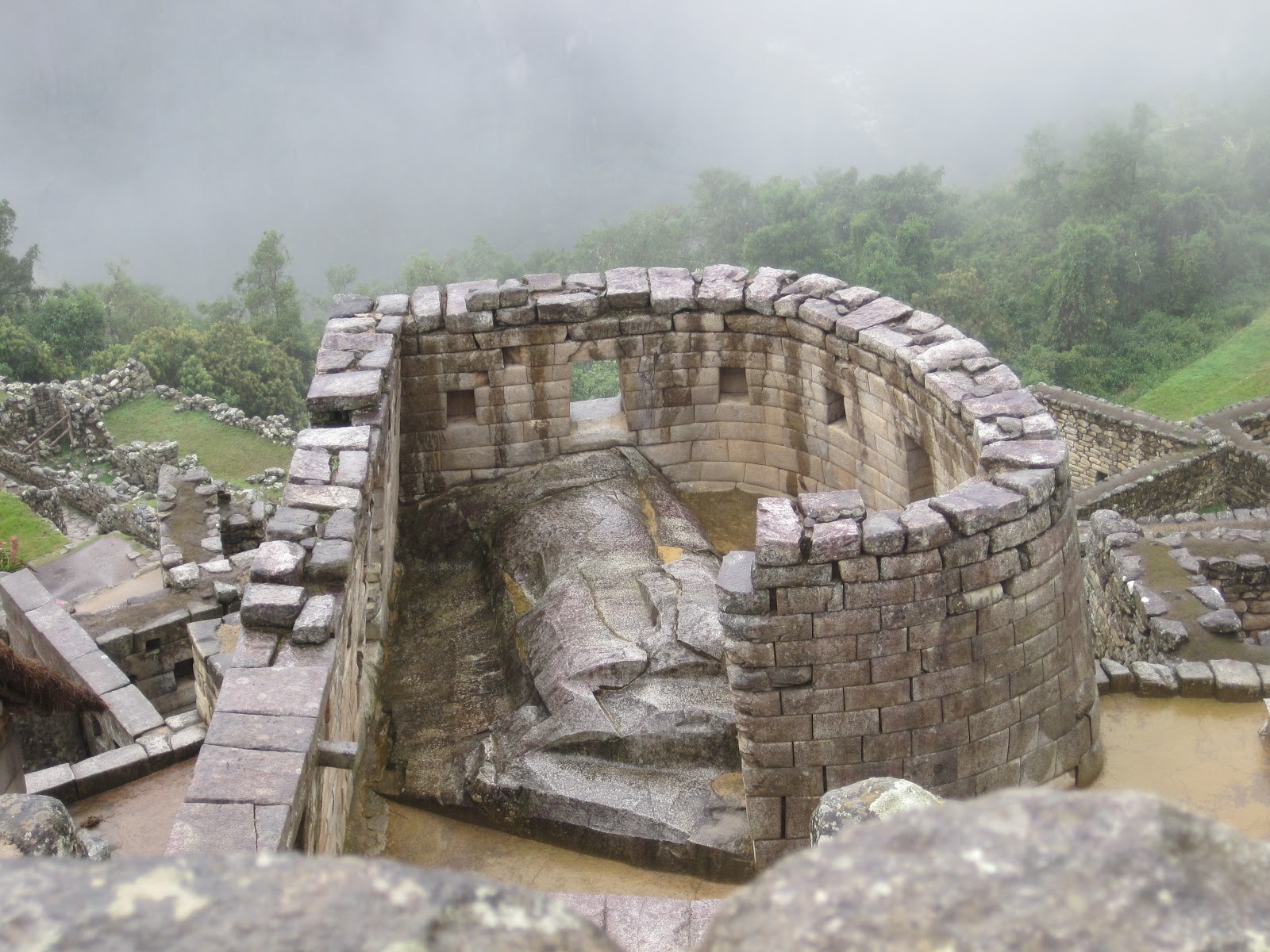
The Temple of the Sun, identified by its rounded exterior wall still houses an altar used for sacrifice. If you look out the windows of the temple you can view across to different parts of the city. Under the temple is another smaller temple dedicated to Pachamama, or Mother Earth. It is built amongst a natural upthrusting of gargantuan rocks. Although we were not allowed inside, there is evidence that it was used for ceremonial purposes.


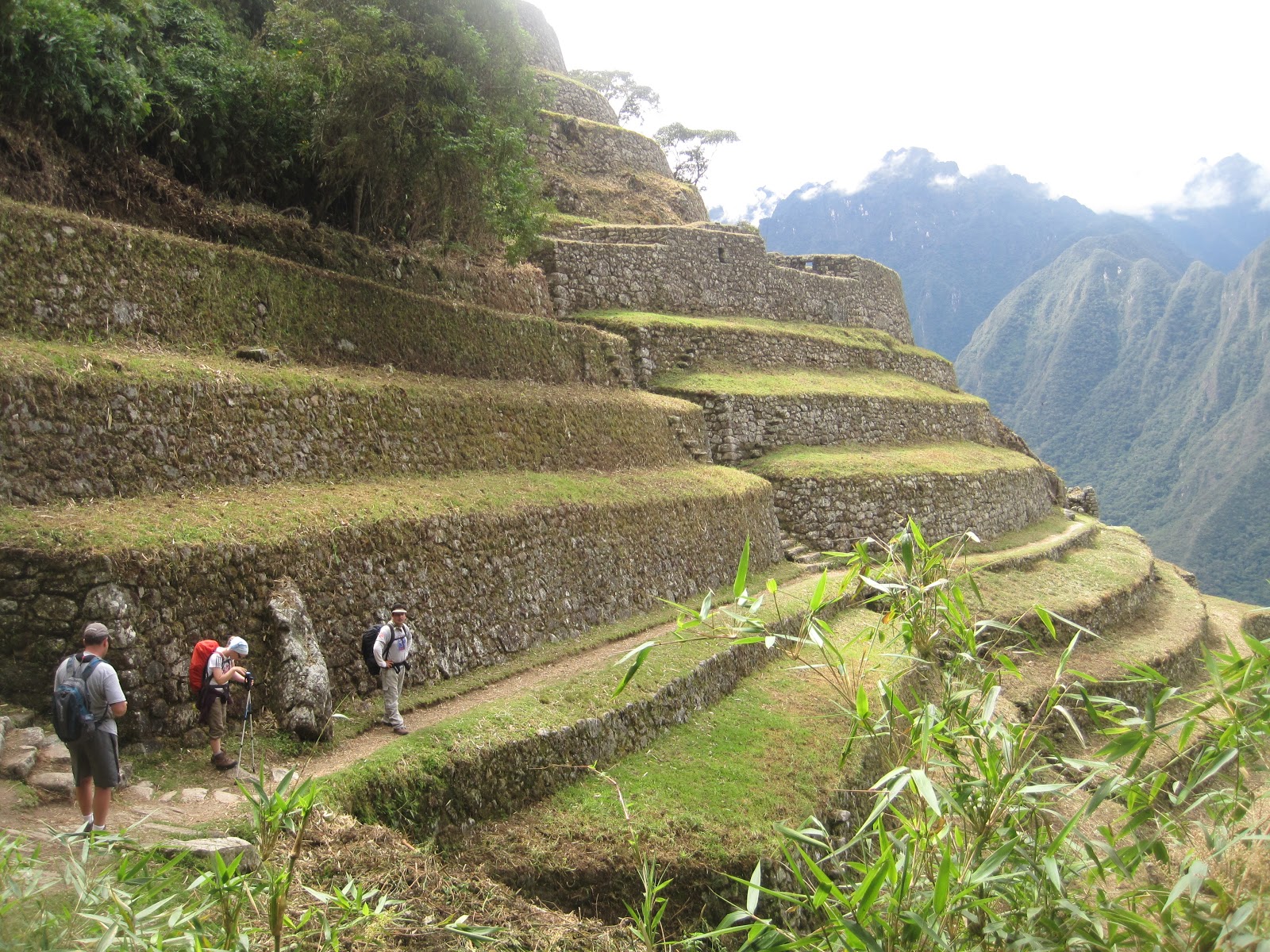
The city is in excellent condition, with very little damage from settling and earthquakes. On the left was one of the few walls that we could see damage by such things, not bad for 500 years.  There is minimal damage due to erosion and this is attributed to the extraordinary canal system built throughout the entire city.

I was very impressed with the expansive nature of the site. It was much larger than I had thought when I have watched television specials about Machupicchu. Some of the bricks used at the base of the walls are enormous. I wondered how they could move them and shape them to fit exactly to the next stone.  The quarry from whence the rocks were hewn was inside the boundaries. Structures and terraces were built both above and below the quarry.

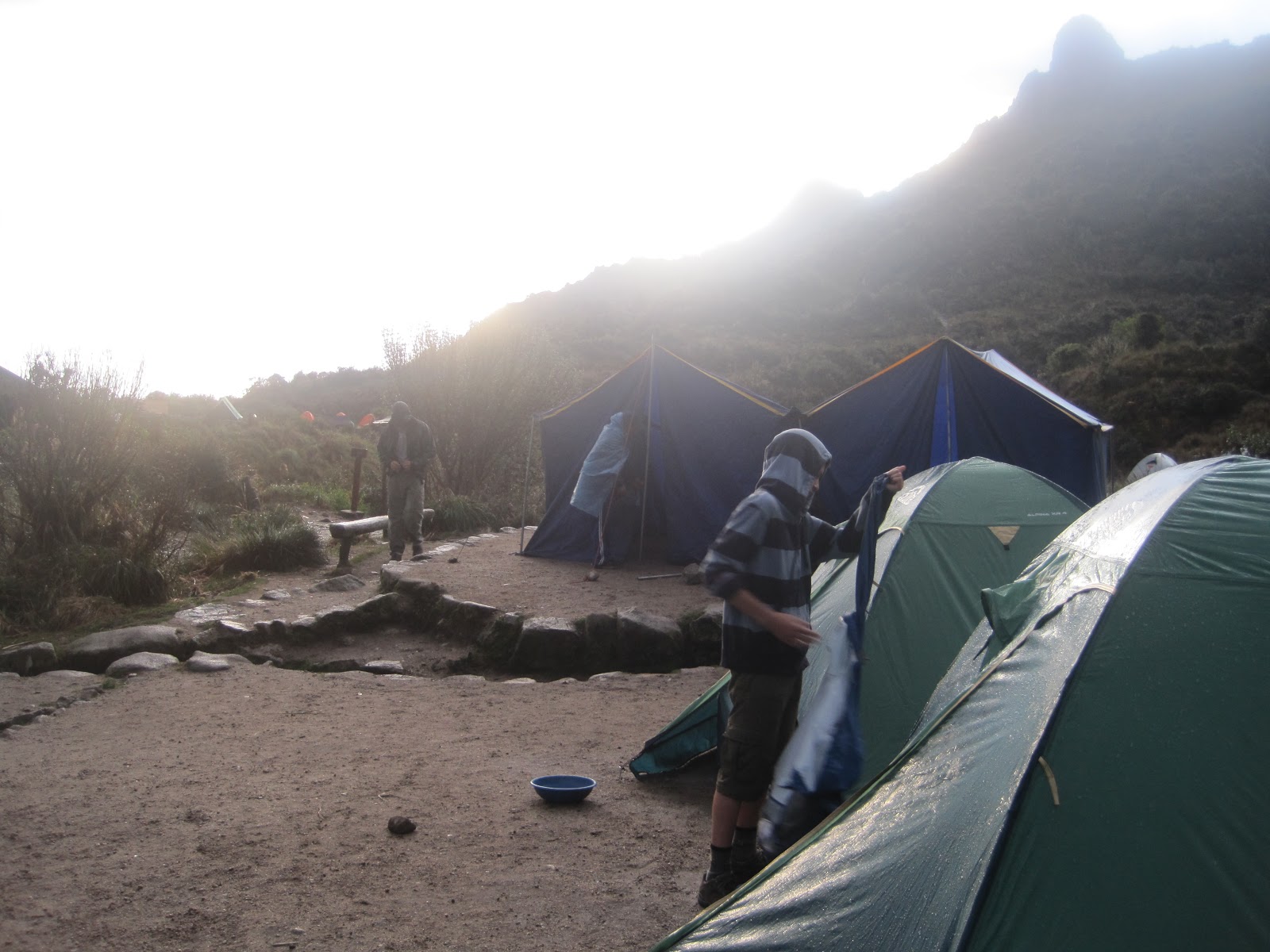
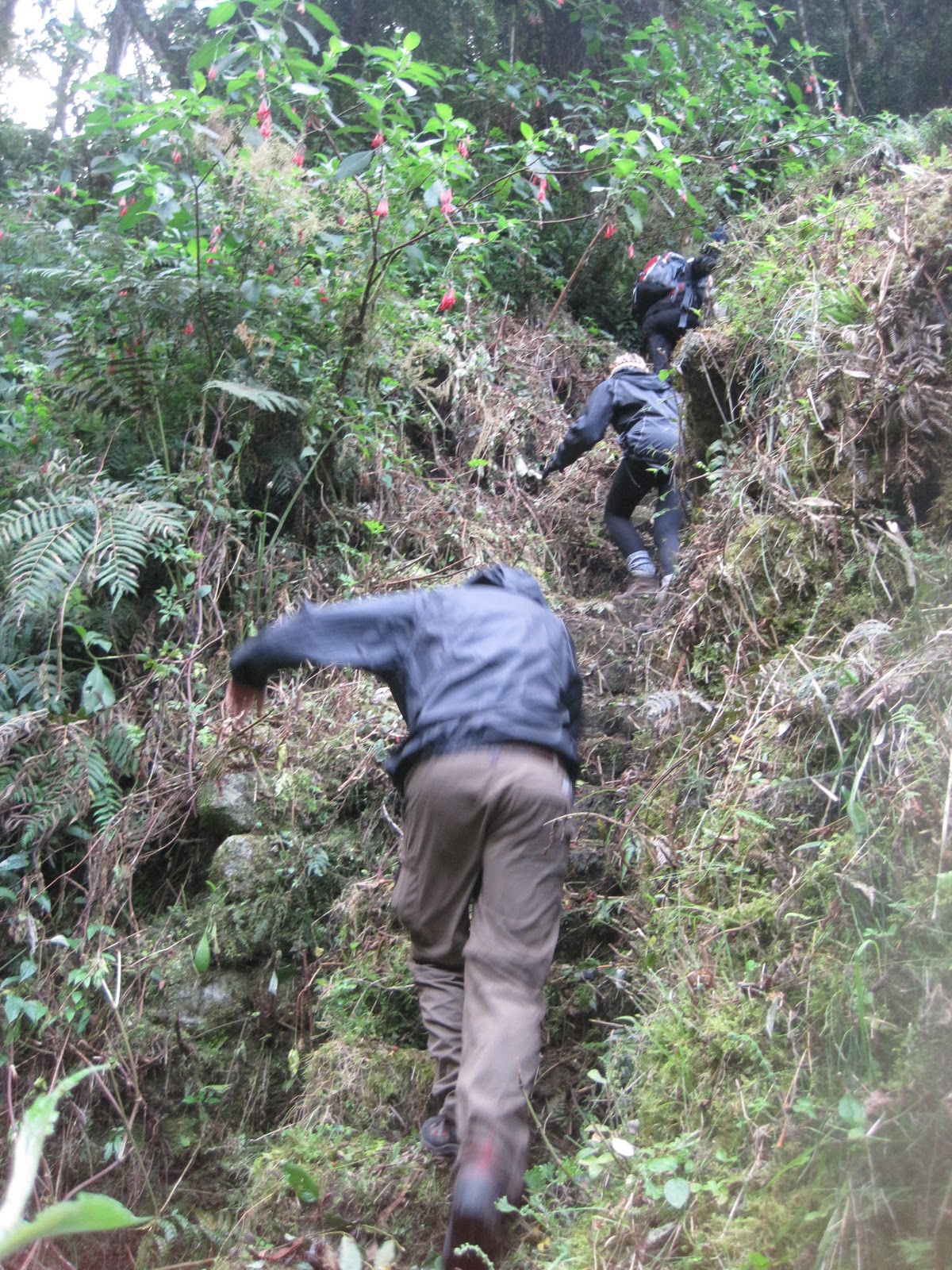
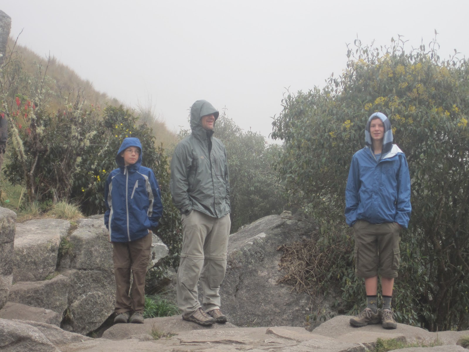
The rain did not let up as we toured the city. We discovered that our waterproof jackets weren't. We were tired, for we had been up since 4:00. We were hungry, for we hadn't eaten since 4:30. We were cold, for our clothes were soaked and the clouds shielded the sun's warmth. Although I had anticipated experiencing Machupicchu for many years plus four long days, I needed to leave Machupicchu, and soon. I could have explored for hours, but with three hungry boys grouching in my ear, I resigned myself to the fact that I will have to see Machupicchu in its entirety another day. Next time, by train.


Inca Trail - Day 4

We were awakened in the dark by our guide tapping on the tent and shining a flashlight. We had to arise before 4 a.m. so that we could reach Inti Punku, the Sun Gate, by sunrise. We were a pretty quiet bunch as we huddled in the food tent for breakfast trying not to get wet from the steady rainfall. We prepared our packs by headlamp before leaving camp a final time. We got to the checkpoint and stood in line in the rain, in the dark, waiting for the park officials to open the gate so we could begin our final hike.

We hiked for a couple of hours while it drizzled and slowly turned light as dawn approached. Our last bit of the trail before arriving at Inti Punku was the steepest set of stairs ever. This photo I took at the top of the stone steps that led to the Sun Gate.

The rainfall increased as we waited for the rest of our party to climb the stairs and we had to hide our cameras and try to cover our packs to keep things from getting even wetter. Our reason for arriving at Inti Punku was to overlook Machupicchu as the sun rose in the east. Well, all we were able to see for quite a while was a thick blanket of clouds.


Our first view of Machupicchu
Eventually the covering enshrouding the city drifted aside so that we could see Machupicchu. Although not the photographic image we had hoped for, our view that morning was eerie and beautiful in its own way. I could understand why it was not discovered by anyone until the Yale professor of Latin American history, Hiram Bingham, officially found it in 1911. I'm sure it eluded many before then.

From the Sun Gate to Machupicchu itself was about a 45 minute downhill hike, in the rain. As we descended below the cloud level we were able to see quite clearly the structures and terraces which make up this ancient city. I was amazed at how much there was to see. And to think, much of it is still hidden beneath vine and leaf.
 

Wednesday, June 6, 2012

Inca Trail - Day 3


We arose in the morning to find that it had rained during the night and everything that had touched the sides of the tents was damp.

After breakfast the staff and the hikers were formally introduced to each other, at last. We took some time to take photos and socialize.


After such a difficult hike the day before, we looked forward to todays journey. Our third day was my favorite. The descent was a gradual 700 m. and the distance shorter at 10 km., which made it easier on the heart and lungs and legs. Not only that, but we were able to hike through a high rainforest, which was so beautiful and very different from anything else we had seen thus far.
The scenery was like something out of an adventure movie. The flora was lush and colorful. Moisture soaked moss in colors of yellow, greens and orange clothed the cliff walls. Vines hung from the trees and crossed our paths. We could hear the constant quiet chirping of frogs which live in the overgrowth.

On our way to Phuyupatamarca, or the Town of the Clouds, we passed through two natural tunnels. Here we are(Isaac, Margaret, Steve, and Tyler), posing in one of the rock clefts in our path. Tyler is wearing an alpaca hoodie he purchased at a roadside market the week before.

During a short, midmorning break Steve asked one of the porters if he could try wearing the pack they carry. It is amazing to us that each of these tiny men wear an enormous bag weighing about 75 lbs., keeping it on by holding straps of a woven hammock. They travelled much faster than we did and although some wore haraches or other similar footwear, we never saw one stumble or misstep.

We approached Phuyupatamarca from above and hiked down through the site. The group didn't stay and look around too much for we were all anxious to keep moving along to the next place, although I would have enjoyed looking around a bit more.

One of the features we saw at this site, as well as many other of the Incan places, is a series of interconnected pools descending down from terrace to terrace. It is understood that they may have been used for irrigation and perhaps domestic purposes as well.


The bench terraces that characterize the Incan establishments are amazing feats of engineering. They are built up on steep hillsides with first a layer of large stones, then a layer of smaller stones and then gravel, upon which sand is layered. The topmost layer is soil, which is fertilized by the guinea pig and llama which were raised as livestock. Terracing enabled a variety of crops to be raised in a relatively small area. The temperature and even humidity varied in one farming terrace due to the change in altitude among the steep slopes. They could raise corn, onions, potatoes, coca, beans, quinoa and vegetables all in the same season. Down the center of the terraces was built a canal with intermittent fonts, or chambers, for the irrigation water to fill, which came from run off and underground springs. Along each level ran a small trench leading from the water chambers to the far ends of each terrace, providing water to crops along the entire length of farming area. Each terrace could be accessed by small stairways built into the rock walls.
We soon left the rainforest and hiked down nearly 2,000 steps to Winaywayna. It was a struggle for those in our group with knee problems. Even I was hurting a great deal by the time we reached it, and I don't have issues with my knees. We arrived around midday and explored a great deal. Our guide showed us how most of the establishment was yet to be exposed. The majority was still hidden by the dense overgrowth. It is no wonder that these Incan ruins were not discovered by the world until the late 1800s. He led us up into the jungle to see the hidden village, but I opted to stay on sure ground since the climb was covered in wet, tangled vines and rumored to be a home to various snakes.
 
 We reached our final campsite where we relaxed with a mid-afternoon nap/shower/break. We then walked to a nearby Incan site called Intipata until dusk overtook us. We returned to our campsite and enjoyed a wonderful dinner. We had to sit quite cosily if we all were to fit within the tent flaps. By this time we were all very friendly with everyone in the group and since our day had been less physically stressful, we all enjoyed a fun evening together.


Tuesday, June 5, 2012

Inca Trail - Day 2


  Day 2 was to be the longest hiking day of the week. After a much needed breakfast we started hiking shortly after 7 o'clock. We immediately began our 900 meter ascent to Warmiwanusca, or Dead Woman's Pass. We hiked for hours through the forest up stone steps. We were overtaken by the local women and their llamas. They easily passed up all the hikers, even though their loads were much larger than ours. At our first break there they were, set up with tents selling drinks and other things.
We stopped at a fairly large flat area next to a stream. Steve had brought a woven fabric frisbee that we brought out. We tossed it around, roping some of the Peruvian porters into our game. I don't think they had ever seen or held such a thing, but they soon caught on to the technique. It ended up in the water a couple of times and was quite muddy before we put it away for the day.
We continued our uphill battle, leaving the shade of the forest and continuing up, up, up until late morning when we reached the summit of 4200 m. or 13,776 ft. The view was spectacular.
It was a struggle to get enough oxygen at that altitude. When the last of our party arrived we cheered. We took a long rest at the top to drink, eat, take photos and gear up for the next leg of our journey.


where we came from

where we are going
 At this point we had only accomplished less than half of our hike for the day. We descended the slope into the Pacaymayo Valley stepping down tall uneven rocky steps all the way. It was a real test of our quad strength/endurance and sure-footedness.

After a lunch in the valley, we began our ascent to Runcuracay Pass. Before we reached the summit we stopped at the nearby ruins for a rest and explanation by Ruben.
 Although the day had started out sunny and pleasant, the clouds moved in quickly and turned the tides. We Willis four were the first of our group to reach the pass(3,950 m / 12,956 ft) and sat down to take a rest. It was soon sprinkling and we donned our rain jackets. We soon put our packs on under our jackets and ponchos to keep our things as dry as possible. I was glad I had a rain cover for my pack.


By the time we began our descent it was drizzling. It was not fun hiking down those steep rocks in the rain. We were wishing we had brought walking sticks. We hiked very slowly so as to not twist an ankle or fall on the slick steps and mud. We took no photos and had no desire to stop at the ruins of Sayacmarca, which should be proof enough of the challenge that we were experiencing. The temperature dropped twenty degrees, perhaps, and the rain continued as the daylight hours crept away. We had to turn on our headlamps before making it to our campsight drenched, exhausted and famished. Again, we were grateful for the porters who carried the bulk of our gear and set up our tents in the rain before we arrived.

After we got to our camp at Chakicocha, the rain let up and the clouds parted to let us see the last rays of sunshine of the day. We camped at an elevation of 3,400 m, or 11,000 ft. It was a chilly night.

Monday, June 4, 2012

Inca Trail - Day 1

We unloaded from the bus at mile marker in Piscacucho (2680 m.). After checking in at the control station with our passports and trail permits, we entered the Inka Trail. We first crossed the Urubamba River and began walking the dusty path through the high desert. There were cactus growing along the way and very little shade. The weather was mild - perhaps 60-70 degrees F.
There were spots in various places along the way where local women were selling anything from water to hats. After a couple of hours we took our first break. We stopped at seated area shaded by trees and enjoyed the rest, as well as food and water.

In the late morning we came upon our first of many Inca ruins we would see on our trek. Willkarakay was a small and modest settlement built of native stone. Soon after that we hiked upon a bluff and overlooked the valley below to see this most impressive view. The terraced Inca place called Llaqtapata is built along the banks of the Kusichaca River, and from high above we could appreciate its well engineered structure and design. It was easy to see the Incan rule of three displayed in the terraces on the right, closest to the river. This theme is repeated almost everywhere we looked.

Isaac at Willkarakay
Llaqtapata
The first level, depicted by the snake, represents the underworld. The next level means the earth and is symbolized by the powerful puma. The third is shown by the condor and equates to heaven.


Shortly before lunchtime our guides recieved word that the couple from the UK that failed to show the night before were going to join us. Cesar went back to wait for them at the control point. He would guide them along the trail. The rest of us hiked on with Ruben. We thought they might catch up with us at the stopping place for lunch since we stayed there and rested for so long, but we would not see them until evening.


After lunch our hike became more interesting. The trail varied as did our surroundings. As we increased in slope and elevation, we were very grateful that we had porters to help us carry our belongings. The packs they carried on their backs were almost as big as they were.


Periodically we would see evidence of local people living nearby the trail. Through the trees we could see a gate or a tiny home. We came across a couple of young boys. One was climbing a tree and the other was wearing a cape. We called the one Batman and the other Spiderman. They liked their new names!


The last bit of our hike was through the woods along a stream. Tyler, Isaac, and Steve seemed to have boundless energy and quickly made it to the campsite. They put down their packs and came back down the trail to help to carry the packs of the rest of us who were slower and more exhausted. By the time I reached our campsite at Ayapata (3250 m.) I needed to lay down and take a short rest. I was pleased that my boys were so willing to serve the others in our group. Our tents were all set up by the porters who had run the trail to get everything ready for us. There were a number of hole-in-the-floor-with-a-door toilets and running water for washing hands, but not for drinking.

Shortly after our party straggled in, along came Cesar with Cat and Dave, our missing fellow hikers from the UK. The 12 kilometers which had taken us nearly eight hours to hike, they ran in four hours. We were all together that night for dinner in the food tent. The meal was fabulous. I don't remember ever having food on a hike that tasted so good. It beats MREs.